Google Earth kmz file: Click kmz to view all tracks
directly in Google Earth.
Note that Google Earth will let you see each track
individually.
kmz
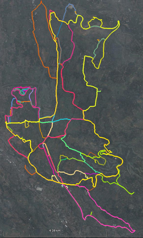
Google Earth kml file: Translate gps tracks into many other formats with gpsbabelGUI
kml
Garmin Database file: Use this file with Mapsource to view the tracks and load the tracks into your Garmin GPS device.
gdb
09:00 (or earlier) to 13:00 on Sunday and on Friday between 10:30 and 12:30 seem to be the best times for avoiding traffic on the "bigger" roads. But most days are fine on the back roads. I never bike on main roads. If you are coming from Jakarta, why not stay at the Novotel which is in the heart of this biking area. This rural biking opportunity may not last long.... the landscape is changing fast... becoming suburban and urban.
MORE: I use a Garmin etrex Vista HCx GPS. I have been editing a Garmin type map for biking in this area. I am not an expert on editing maps, but I am using the FREE Map Set for Indonesia from Navigasi (http://navigasi.net/goptd.php). If you would like to try that, go to that site and click on 'mendownload'. When you install these maps, Garmin Mapsource can find them. When you look in the directory on your hard disk where the img files are stored by the Navigasi install, you will see a bunch of numbered img files. ..... ( Note: These .img files are not picture files.)
The one numbered:62320000.img is the one for the Bogor aea.
I have been editing this img file using GPSmapedit (http://www.geopainting.com/en/).
My latest edited version of 62320000.img can be downloaded here. (4.6MB)
On this I have added a number of smaller roads in my biking area.
To use this file I think you have to install the Navigasi map set, and then substitute my file for the one with the same number that you got from Navigasi. Then use MapSource to load maps in to the GPS device. There is also a way to load the img file directly but I'll let you figure that out.
I am leaving Indonesia soon so maybe someone would like to take up this little "project".
Note: Free Mapsource software Even if you do not use a Garmin (or any) GPS, you can install Mapsource on your computer by following the directions shown on this linked site. This will allow you to look at the above information in detail on your computer.